


How does the dual light pod achieve millisecond-level synchronization between flight path and imaging, precisely triggered by high and low voltage levels from the flight control?
Release Time : 2025-09-15
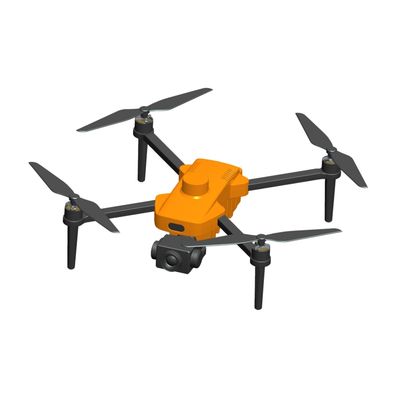
In drone aerial surveying, image acquisition accuracy directly determines the reliability of subsequent modeling, mapping, and analysis. Especially at high speeds or in complex terrain, even the slightest deviation between the camera's capture time and flight position can lead to misalignment, insufficient overlap, or angular distortion in the captured images, seriously impacting the accuracy of orthophoto stitching and 3D reconstruction. The key to the dual light pod's ability to handle such high-precision tasks lies in its deep collaboration with the flight control system. High and low voltage signals from the flight control precisely trigger shooting, achieving millisecond-level synchronization between flight path and imaging, ensuring that every shutter click lands at the most accurate spatial coordinates.
The core of this synchronization mechanism lies in transforming the camera's "photography" behavior from a passive operation to a controlled command. Traditional aerial photography often relies on timers or manual triggering, which cannot ensure strict alignment between the capture moment and the flight trajectory. The dual light pod, on the other hand, connects to the drone's flight control system and receives real-time trigger signals generated by the navigation algorithm. When the aircraft reaches the predetermined location along its pre-set route, the flight control system determines the optimal capture moment based on its current speed, altitude, and geographic coordinates, and immediately outputs a brief high-level pulse. The control unit within the pod detects this signal and instantly activates the camera for exposure and storage. This entire process requires no human intervention and is independent of external communication delays, resulting in fast and repeatable response.
High and low-level triggering is essentially a form of digital logic control, offering extremely high timing determinism. It does not rely on complex protocol parsing or network transmission, but instead transmits the "shoot" command with the simplest voltage change. This low-level, hardware-level communication method avoids the uncertainties associated with software scheduling, ensuring the shortest possible path and lowest latency from flight control decision to camera execution. Even at high speeds, every image is captured directly above the planned location or at the specified angle, achieving true "on-demand imaging."
More importantly, this mechanism supports seamless integration with the PPK (Post-Differential Positioning) system. With each capture trigger, the system automatically records a precise GNSS timestamp and embeds position and attitude information into the photo metadata. This means that each image is not just a visual image but also a geographic information node with precise spatial and temporal coordinates. During post-processing, high-precision aerial triangulation can be achieved without the need for a large number of ground control points, significantly improving operational efficiency and the reliability of the results.
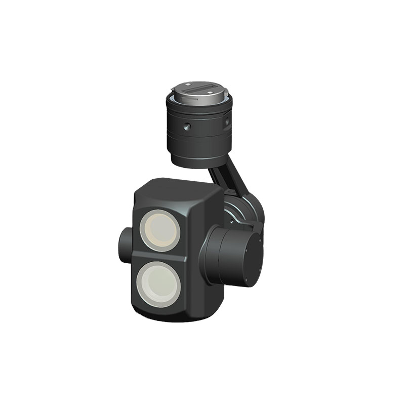
The dual-light pod's dual-camera design further enhances synchronization capabilities. In multi-directional acquisition mode, the two cameras can perform orthographic and oblique photography depending on mission requirements. Flight control signals can trigger different cameras simultaneously or in a time-sharing manner, ensuring temporal and spatial consistency of multi-view images. Whether constructing urban facade models or monitoring slope deformation, highly coordinated datasets can be obtained.
In addition, the use of a mechanical inter-lens shutter enhances the controllability of the imaging process. Compared to electronic shutters, which are susceptible to motion interference, mechanical shutters physically open and close to control exposure, resulting in more stable response and effectively reducing image blur during high-speed flight. Combined with level triggering, this creates a fully precise control closed loop from "command-execution-imaging."
Ground station software provides visual support for this synchronization process. Operators can monitor the camera's operating status, number of images captured, and trigger history in real time during flight. If an anomaly is detected, remote intervention or parameter adjustments can be made, preventing data loss until after return. This fully monitorable, controllable, and traceable operation significantly enhances confidence in the field.
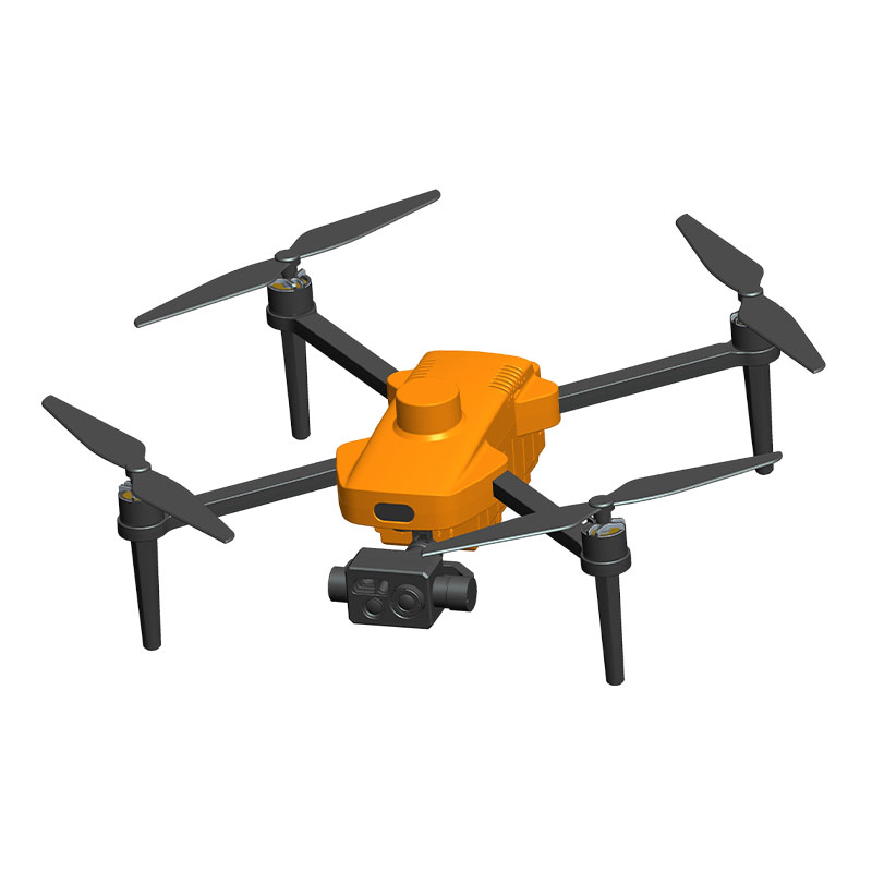
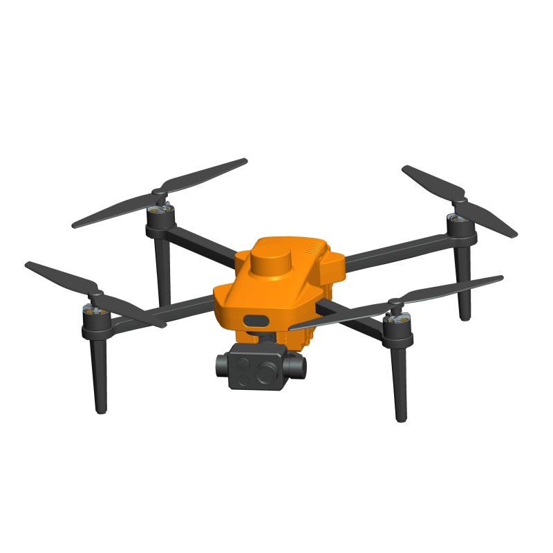
Whether the drone traverses mountain ridges, flies past buildings, or hovers over an accident scene, the Dual Light Pod captures every frame with a calm and precise rhythm. It relies neither on luck nor post-processing; instead, through a hard-wired connection between the flight control and the camera, the flight trajectory is firmly tied to the moment of imaging. This millisecond-level rapport is more than a simple overlay of technologies; it embodies the deep integration of intelligent perception and autonomous control. It is this precision that makes the Eye in the Sky a truly reliable starting point in the world of surveying and mapping.
The core of this synchronization mechanism lies in transforming the camera's "photography" behavior from a passive operation to a controlled command. Traditional aerial photography often relies on timers or manual triggering, which cannot ensure strict alignment between the capture moment and the flight trajectory. The dual light pod, on the other hand, connects to the drone's flight control system and receives real-time trigger signals generated by the navigation algorithm. When the aircraft reaches the predetermined location along its pre-set route, the flight control system determines the optimal capture moment based on its current speed, altitude, and geographic coordinates, and immediately outputs a brief high-level pulse. The control unit within the pod detects this signal and instantly activates the camera for exposure and storage. This entire process requires no human intervention and is independent of external communication delays, resulting in fast and repeatable response.
High and low-level triggering is essentially a form of digital logic control, offering extremely high timing determinism. It does not rely on complex protocol parsing or network transmission, but instead transmits the "shoot" command with the simplest voltage change. This low-level, hardware-level communication method avoids the uncertainties associated with software scheduling, ensuring the shortest possible path and lowest latency from flight control decision to camera execution. Even at high speeds, every image is captured directly above the planned location or at the specified angle, achieving true "on-demand imaging."
More importantly, this mechanism supports seamless integration with the PPK (Post-Differential Positioning) system. With each capture trigger, the system automatically records a precise GNSS timestamp and embeds position and attitude information into the photo metadata. This means that each image is not just a visual image but also a geographic information node with precise spatial and temporal coordinates. During post-processing, high-precision aerial triangulation can be achieved without the need for a large number of ground control points, significantly improving operational efficiency and the reliability of the results.
The dual-light pod's dual-camera design further enhances synchronization capabilities. In multi-directional acquisition mode, the two cameras can perform orthographic and oblique photography depending on mission requirements. Flight control signals can trigger different cameras simultaneously or in a time-sharing manner, ensuring temporal and spatial consistency of multi-view images. Whether constructing urban facade models or monitoring slope deformation, highly coordinated datasets can be obtained.
In addition, the use of a mechanical inter-lens shutter enhances the controllability of the imaging process. Compared to electronic shutters, which are susceptible to motion interference, mechanical shutters physically open and close to control exposure, resulting in more stable response and effectively reducing image blur during high-speed flight. Combined with level triggering, this creates a fully precise control closed loop from "command-execution-imaging."
Ground station software provides visual support for this synchronization process. Operators can monitor the camera's operating status, number of images captured, and trigger history in real time during flight. If an anomaly is detected, remote intervention or parameter adjustments can be made, preventing data loss until after return. This fully monitorable, controllable, and traceable operation significantly enhances confidence in the field.
Whether the drone traverses mountain ridges, flies past buildings, or hovers over an accident scene, the Dual Light Pod captures every frame with a calm and precise rhythm. It relies neither on luck nor post-processing; instead, through a hard-wired connection between the flight control and the camera, the flight trajectory is firmly tied to the moment of imaging. This millisecond-level rapport is more than a simple overlay of technologies; it embodies the deep integration of intelligent perception and autonomous control. It is this precision that makes the Eye in the Sky a truly reliable starting point in the world of surveying and mapping.