


Can hydraulic flow radar maintain data stability and reliability under complex water surface conditions?
Release Time : 2025-09-01
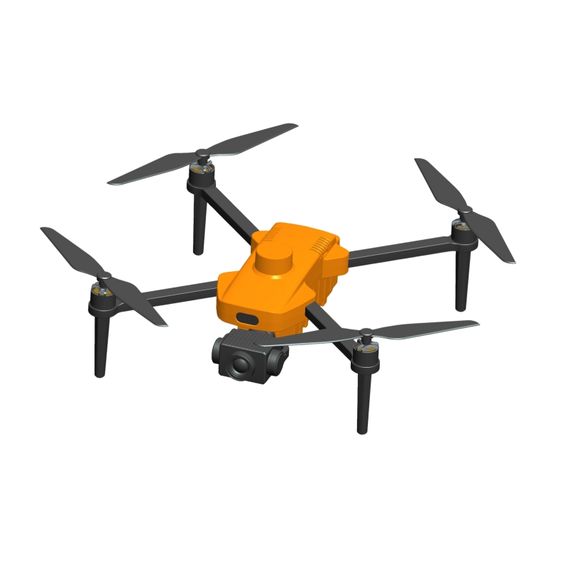
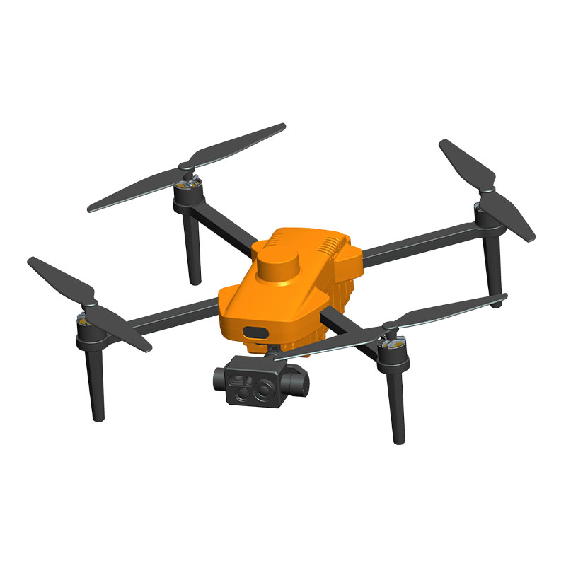
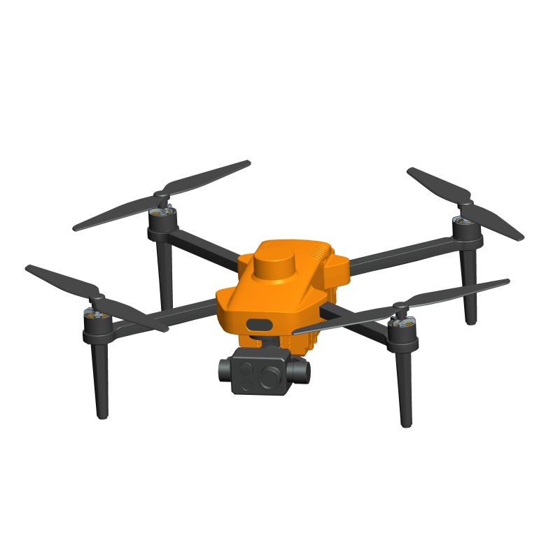
Whether hydraulic flow radar can maintain data stability and reliability under complex water surface conditions is a key test of its technical maturity and practical value. Natural water flows are rarely ideal. Factors such as wind and wave disturbances, floating debris, rain and snow interference, sudden water level fluctuations, and vegetation cover often cause the water surface to exhibit fragmented, undulating, and even partially stagnant conditions. In these non-stationary environments, traditional contact flow measurement equipment can fail due to blockage, entanglement, or mechanical wear. However, hydraulic flow radar, with its non-contact measurement principle and intelligent signal processing capabilities, demonstrates unique advantages and adaptability.
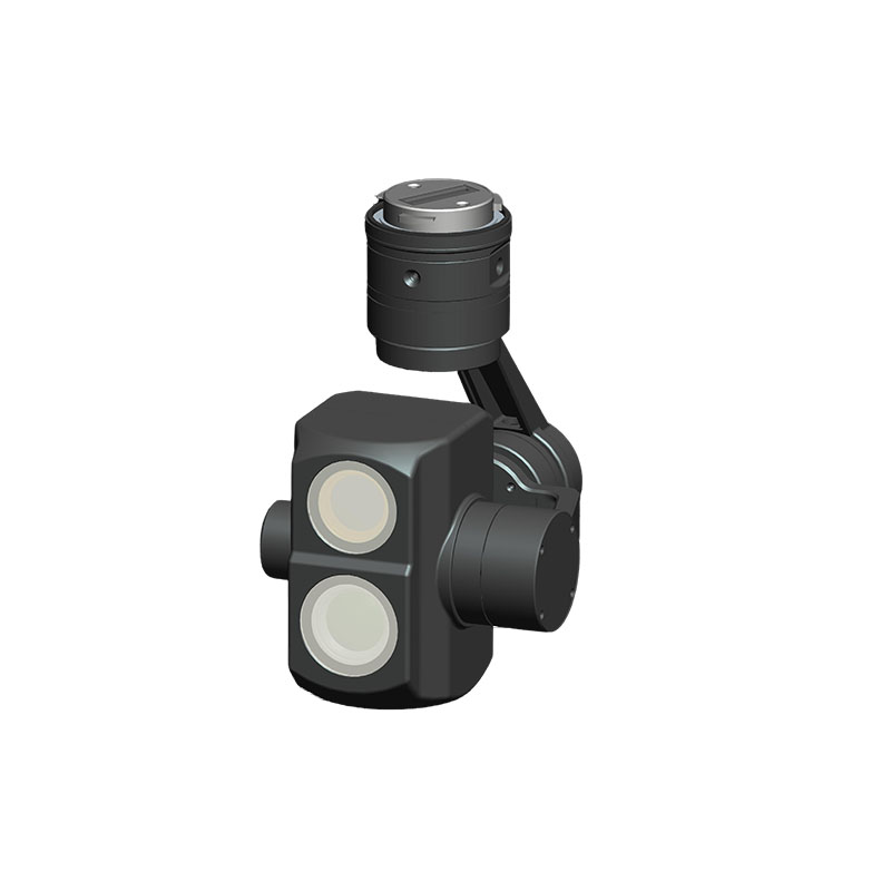
The core of radar flow measurement lies in capturing the velocity of surface particles moving with the flow. It transmits an electromagnetic beam to illuminate the water surface, receives signals reflected by tiny ripples or floating objects, and calculates the velocity of the reflection point using the Doppler shift principle. This process requires no direct contact with the water, fundamentally eliminating the risk of the sensor becoming entangled in silt, debris, or aquatic plants. Even in densely packed river sections, radar can penetrate the cluttered surface layer and identify representative flow characteristics. Modern equipment utilizes narrow beam focusing technology to confine the measurement area to the mainstream, minimizing interference from shoreline turbulence or calm water areas, ensuring accurate flow velocity information.
To cope with the dramatic surface fluctuations caused by wind and waves, radar systems employ advanced signal filtering and pattern recognition algorithms. While simple wave motion exhibits periodic and reciprocating characteristics, true water flow exhibits a unidirectional, continuous motion. By analyzing the time series characteristics of the echo signal, radar distinguishes wind-driven oscillations from net velocity driven by gravity, automatically eliminating invalid fluctuations and extracting a stable baseline velocity value. Some high-end equipment also incorporates machine learning models that learn flow patterns over time in specific sections, further enhancing their ability to discern complex disturbances.
Rainy and snowy weather poses another challenge to radar flow measurement. Rainfall can create a large number of suspended water droplets in the radar beam path, generating false echoes; snowfall can also cover the antenna surface, affecting signal transmission. To this end, the equipment is typically equipped with high-penetration electromagnetic bands and dynamic background noise suppression, enabling it to identify and filter out spurious signals caused by precipitation. The housing design features an angled angle and a hydrophobic coating, allowing rainwater to quickly drain away, preventing water from pooling in front of the antenna and forming a reflective barrier. Some models also include integrated heating to prevent ice formation in low-temperature environments, ensuring a smooth signal path.
In areas with low or slow flow, the water surface is as calm as a mirror, lacking sufficient reflective targets, which can result in weak signals or even loss. Hydrological flow radars enhance their ability to capture weak echoes by increasing transmit power and using high-sensitivity receivers. Furthermore, they employ long-term integration and multi-pulse accumulation techniques to separate weak but continuous motion signals from background noise, enabling stable tracking of extremely slow water flows. This allows for continuous monitoring data even during ecological baseflow or dry seasons.
The equipment's mounting position and angle are also scientifically optimized. A suitable pitch angle prevents specular reflections from the beam hitting the water surface, reducing signal saturation. The appropriate mounting height ensures that the measurement area covers the main flow section and avoids near-shore turbulence. Precise tuning, tailored to the site's topography and flow characteristics, is a prerequisite for ensuring data reliability.
Ultimately, the hydraulic flow radar's stable performance in complex water conditions stems from its dual capabilities of "perception + intelligence." It not only receives physical signals but also interprets environmental information. Through continuously evolving algorithms and robust hardware design, it can capture realistic flow patterns in wind and waves, maintain clear signals in rain and snow, and lock onto effective targets amidst debris. This all-weather, all-conditions monitoring capability makes it an indispensable sensing node in modern hydrological station networks, providing solid data support for water resource management, flood control, and ecological protection.