


How does a single-light mapping quadrotor drone improve the resolution of single-band data through spectral calibration?
Release Time : 2025-11-19
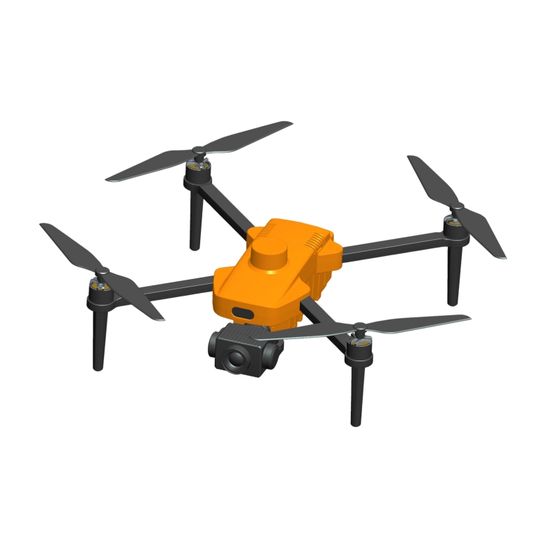
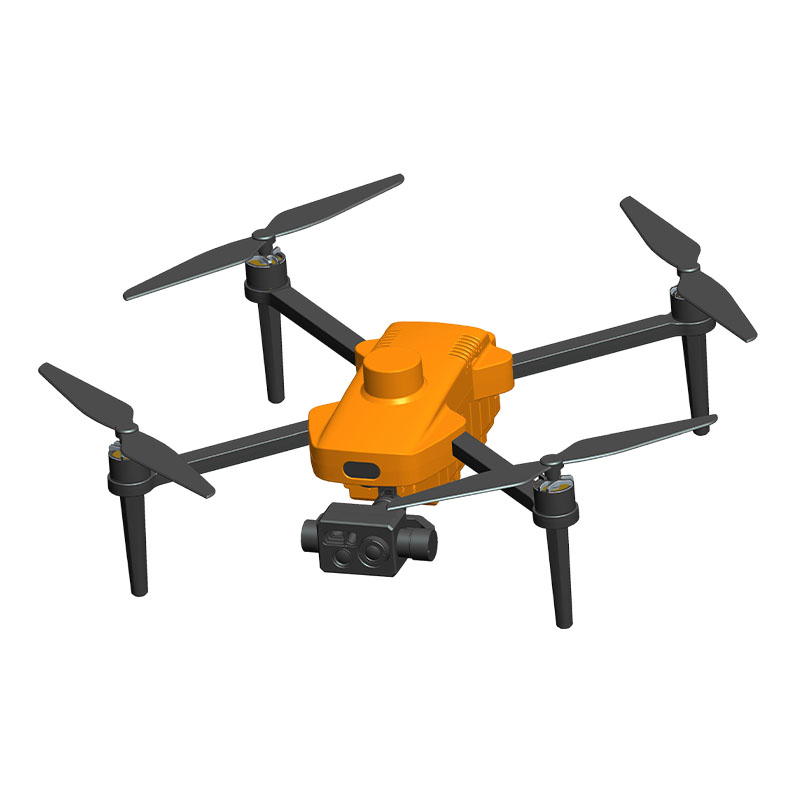
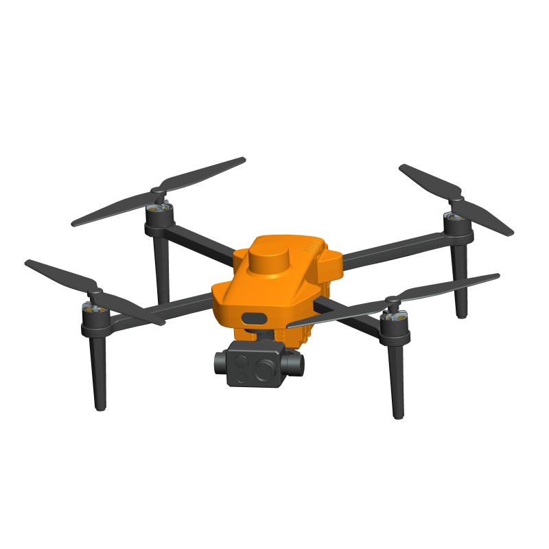
In the field of professional remote sensing and geographic information acquisition, single-light mapping quadrotor drones are continuously evolving towards higher precision, higher efficiency, and lighter weight. Although multispectral and hyperspectral imaging systems can provide rich spectral information, mapping drones using a single light source still dominate in scenarios limited by cost, weight, and data processing complexity.
1. Narrowband Filtering and Light Source Stability: Locking in Key Band Information
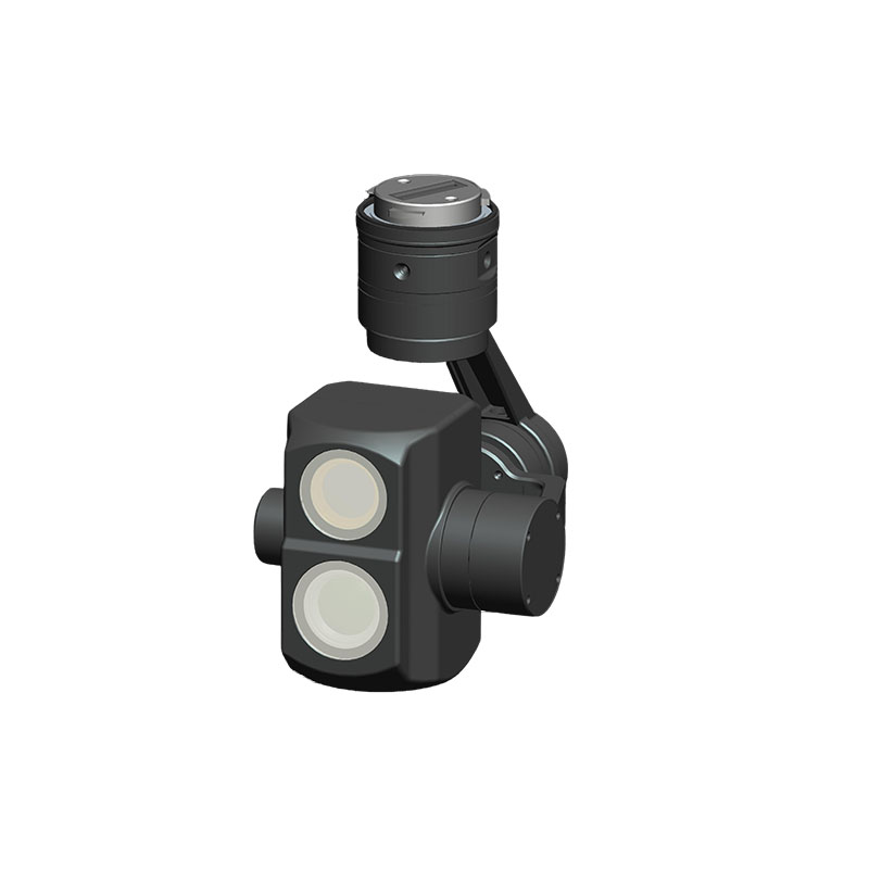
Although a single-light mapping quadrotor drone uses only one main imaging band, its core lies in strictly limiting the spectral response to a narrow target band using high-precision optical filters. This "focused" spectral design effectively filters out stray light and atmospheric interference, significantly improving the signal-to-noise ratio. Simultaneously, the onboard LED or laser-assisted light source has a constant current drive and temperature compensation mechanism, ensuring high consistency in output spectral peaks and intensities under different ambient lighting conditions. This stability guarantees the comparability of aerial data from multiple sorties and across different time periods, laying the foundation for long-term monitoring projects.
2. Radiometric Calibration and Dynamic Range Extension: Uncovering Pixel-Level Details
The resolution of a single-band image depends not only on spatial resolution but also, and perhaps more importantly, on radiometric resolution—the ability to distinguish minute differences in brightness. Modern single-light mapping quadrotor drones undergo rigorous radiometric calibration before leaving the factory, establishing a mapping between sensor digital values and the actual reflectivity of the ground surface. During flight, the accompanying ground station software monitors exposure parameters in real time, and a dual-axis stabilized gimbal ensures stable imaging attitude, avoiding overexposure or underexposure due to camera shake. Some high-end models also support HDR compositing or multi-frame exposure fusion, preserving highlight and shadow details while increasing the effective dynamic range to over 12 bits, allowing the same image to clearly depict both bright rooftops and the textures of dark forest terrain.
3. Spectral-Geometric Joint Optimization: Improving Ground Feature Recognition Accuracy
While single-band data lacks color information, efficient ground feature classification can still be achieved through deep fusion of spectral calibration and a high-precision positioning system. The device supports RTK/PPK high-precision positioning, embedding precise latitude, longitude, elevation, attitude angle, and satellite time information into each image. Aerial triangulation and orthorectification are performed via ground station software. Based on this, combined with terrain simulation flight capabilities, the UAV can automatically adjust its flight altitude according to a preset digital elevation model, ensuring consistent image scale across the entire survey area. When narrowband spectral response and millimeter-level geometric accuracy work together, even single grayscale images can accurately distinguish typical features such as farmland, roads, water bodies, or buildings through differences in texture, shape, and reflection intensity.
4. Intelligent Post-processing and Software Customization: Unleashing Data Potential
To maximize the value of single-band data, the system's accompanying ground station software supports online firmware upgrades and function customization. Users can load specific interpretation algorithms according to project needs—such as vegetation index estimation based on a simplified NDVI model, or extracting linear features using edge enhancement filtering. Furthermore, all image data is stored with hardware-level encryption to ensure the security of surveying results; the integrated charging and transport box ensures rapid deployment and maintenance of the equipment during field operations. Even in emergency situations such as low voltage, the drone can autonomously sound an alarm, return to base, and land safely, ensuring data integrity.
The single-light mapping quadrotor drone is not a "functional simplification," but rather leverages spectral calibration as a core technology to deeply extract information density within a single band, achieving efficient, reliable, and low-cost professional mapping. It uses narrowband filtering to lock onto key signals, radiometric calibration to restore true reflections, high-precision navigation to imbue geometry with meaning, and intelligent software to activate data potential. With a solid foundation supporting BeiDou single-mode navigation, RTK/PPK positioning, autonomous flight, and end-to-end safety protection, this type of drone is becoming a practical choice for fields such as land surveys, agricultural monitoring, and emergency mapping—proving that sometimes, focusing on a single band allows for clearer, farther, and more accurate observations.
1. Narrowband Filtering and Light Source Stability: Locking in Key Band Information
Although a single-light mapping quadrotor drone uses only one main imaging band, its core lies in strictly limiting the spectral response to a narrow target band using high-precision optical filters. This "focused" spectral design effectively filters out stray light and atmospheric interference, significantly improving the signal-to-noise ratio. Simultaneously, the onboard LED or laser-assisted light source has a constant current drive and temperature compensation mechanism, ensuring high consistency in output spectral peaks and intensities under different ambient lighting conditions. This stability guarantees the comparability of aerial data from multiple sorties and across different time periods, laying the foundation for long-term monitoring projects.
2. Radiometric Calibration and Dynamic Range Extension: Uncovering Pixel-Level Details
The resolution of a single-band image depends not only on spatial resolution but also, and perhaps more importantly, on radiometric resolution—the ability to distinguish minute differences in brightness. Modern single-light mapping quadrotor drones undergo rigorous radiometric calibration before leaving the factory, establishing a mapping between sensor digital values and the actual reflectivity of the ground surface. During flight, the accompanying ground station software monitors exposure parameters in real time, and a dual-axis stabilized gimbal ensures stable imaging attitude, avoiding overexposure or underexposure due to camera shake. Some high-end models also support HDR compositing or multi-frame exposure fusion, preserving highlight and shadow details while increasing the effective dynamic range to over 12 bits, allowing the same image to clearly depict both bright rooftops and the textures of dark forest terrain.
3. Spectral-Geometric Joint Optimization: Improving Ground Feature Recognition Accuracy
While single-band data lacks color information, efficient ground feature classification can still be achieved through deep fusion of spectral calibration and a high-precision positioning system. The device supports RTK/PPK high-precision positioning, embedding precise latitude, longitude, elevation, attitude angle, and satellite time information into each image. Aerial triangulation and orthorectification are performed via ground station software. Based on this, combined with terrain simulation flight capabilities, the UAV can automatically adjust its flight altitude according to a preset digital elevation model, ensuring consistent image scale across the entire survey area. When narrowband spectral response and millimeter-level geometric accuracy work together, even single grayscale images can accurately distinguish typical features such as farmland, roads, water bodies, or buildings through differences in texture, shape, and reflection intensity.
4. Intelligent Post-processing and Software Customization: Unleashing Data Potential
To maximize the value of single-band data, the system's accompanying ground station software supports online firmware upgrades and function customization. Users can load specific interpretation algorithms according to project needs—such as vegetation index estimation based on a simplified NDVI model, or extracting linear features using edge enhancement filtering. Furthermore, all image data is stored with hardware-level encryption to ensure the security of surveying results; the integrated charging and transport box ensures rapid deployment and maintenance of the equipment during field operations. Even in emergency situations such as low voltage, the drone can autonomously sound an alarm, return to base, and land safely, ensuring data integrity.
The single-light mapping quadrotor drone is not a "functional simplification," but rather leverages spectral calibration as a core technology to deeply extract information density within a single band, achieving efficient, reliable, and low-cost professional mapping. It uses narrowband filtering to lock onto key signals, radiometric calibration to restore true reflections, high-precision navigation to imbue geometry with meaning, and intelligent software to activate data potential. With a solid foundation supporting BeiDou single-mode navigation, RTK/PPK positioning, autonomous flight, and end-to-end safety protection, this type of drone is becoming a practical choice for fields such as land surveys, agricultural monitoring, and emergency mapping—proving that sometimes, focusing on a single band allows for clearer, farther, and more accurate observations.