


How can hydrological flow radar simultaneously acquire river flow and water level data in seconds?
Release Time : 2025-11-06
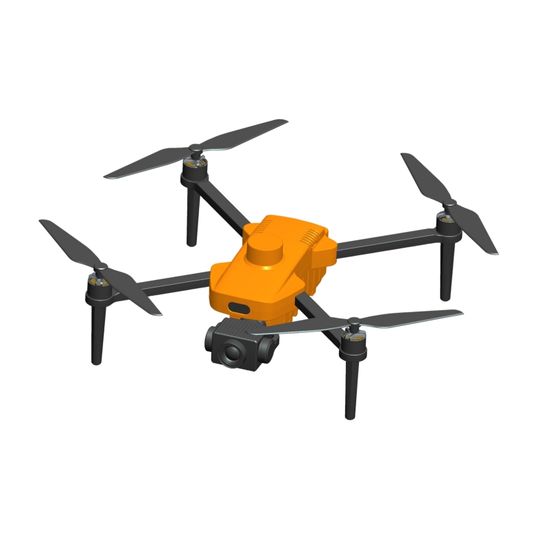
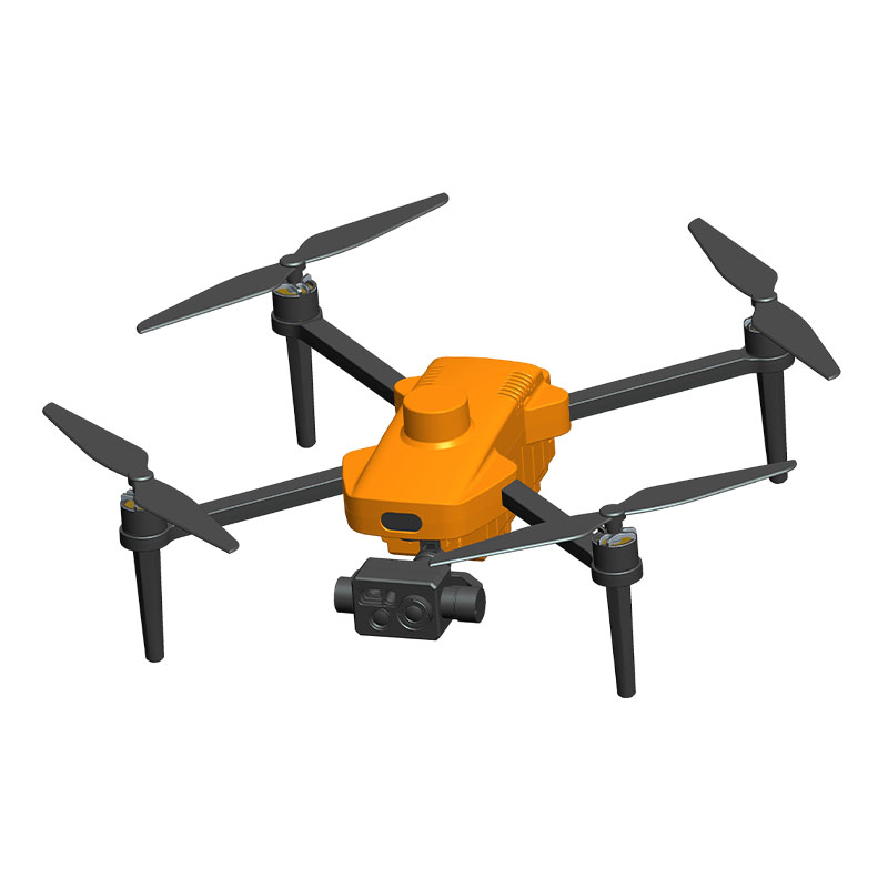
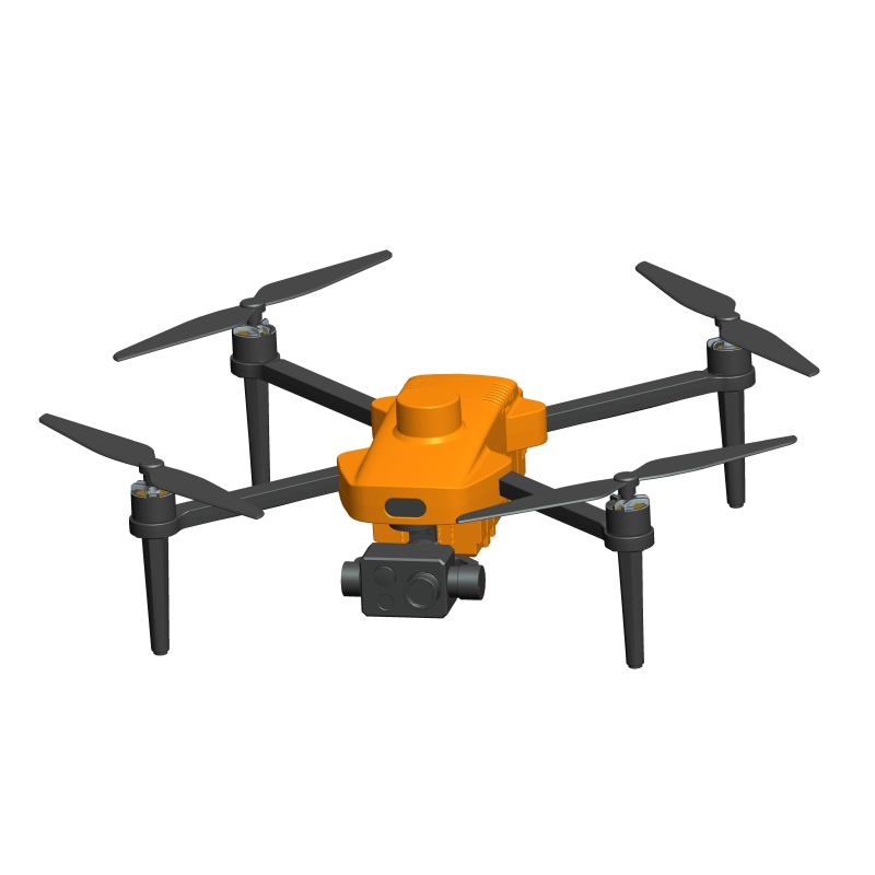
In traditional hydrological monitoring, measuring river flow and water level often requires manual wading, setting up monitoring stations, or relying on fixed equipment, which is not only time-consuming and labor-intensive but also poses safety risks. However, with the integration of drones and millimeter-wave radar technology, the hydrological flow radar system has achieved a revolutionary breakthrough—it only requires the drone to hover for a few seconds to simultaneously acquire water surface velocity, water level, and cross-sectional flow data with high precision and without contact. Behind this high efficiency is the deep collaboration between hardware platforms, intelligent algorithms, and professional software systems.
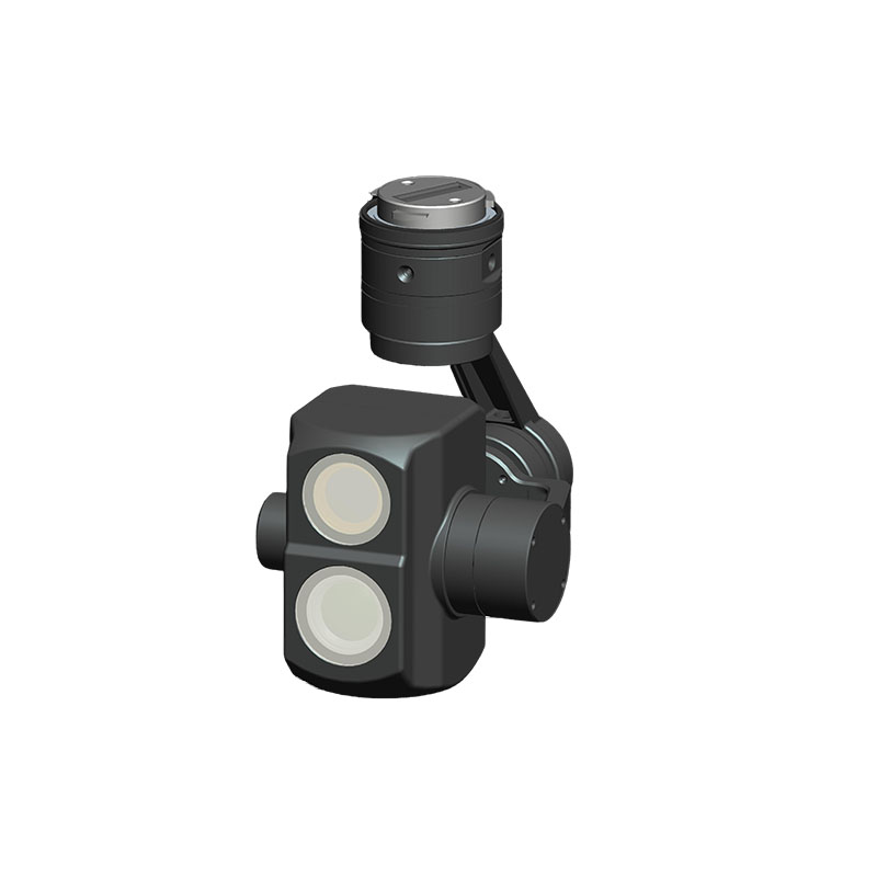
1. Non-contact rapid perception: Precise coordination between radar and gimbal
Hydrological flow radar is typically mounted on the bottom of a drone. It emits high-frequency electromagnetic waves towards the water surface using millimeter-wave Doppler radar and calculates the surface flow velocity using the echo frequency shift. Simultaneously, combined with radar ranging principles, the vertical distance from the drone to the water surface is accurately determined. Combined with the known riverbed elevation, the real-time water level can be retrieved. The entire process requires no contact with the water flow, avoiding interference from floating objects or personnel risks. To ensure measurement stability, the system is equipped with a three-axis stabilized gimbal, which keeps the radar vertically aligned with the water surface even under wind disturbances or slight drone movement, guaranteeing signal quality and data reliability. Real-world testing shows that under ideal conditions, a single-point measurement can be completed in just 3–5 seconds.
2. Intelligent Flight and Automatic Triggering: From "Manual Operation" to "Task-Driven"
Efficient measurement relies not only on hardware but also on intelligent task management. Through the accompanying intelligent construction software platform, users can pre-plan flight routes and set multiple flow measurement cross-section points. After takeoff, the drone will automatically fly along the route and hover at the designated coordinates, automatically triggering radar measurements. The system simultaneously records metadata such as GPS location, altitude, radar signal strength, and gimbal attitude angle, ensuring that each set of flow data has complete spatiotemporal information. This integrated "plan-execution-collection" process significantly reduces human intervention and improves field efficiency and data consistency.
3. Cross-Section Data Fusion: From Surface Velocity to Full-Section Flow
Water surface velocity is only surface data; to calculate the true flow, it is necessary to combine it with the river cross-section morphology. The intelligent construction platform allows users to import or edit cross-sectional longitudinal lines and riverbed elevation data to build digital river models. The system uses an empirical coefficient method or AI-corrected models to extrapolate surface flow velocity to the vertical average velocity, and then combines this with cross-sectional area integration to finally output instantaneous flow rate. Furthermore, the platform supports historical cross-sectional data correction and recalculation; even if riverbed changes are detected later, historical flow results can be updated retrospectively to ensure long-term data accuracy.
4. Elevation Calibration and Coordinate Unification: Ensuring Accurate Water Level Calculation
Different drones have different installation heights; without calibration, this will directly affect the accuracy of water level inversion. The system requires users to input elevation calibration parameters, which are automatically compensated for in the software. Simultaneously, for commonly used domestic map coordinate systems, the platform has a built-in coordinate transformation module that can convert to the internationally recognized WGS84 coordinate system with one click, ensuring spatial alignment between drone positioning and cross-sectional data, and avoiding measurement errors caused by coordinate offset.
5. Closed-Loop Data Management: From Acquisition to Sharing
After measurement, all data is automatically uploaded to the intelligent construction platform, supporting browsing by date, generating standard hydrological reports, and forwarding flow results in real time to third-party platforms such as water conservancy and emergency response, enabling instant data sharing and coordinated response. In addition, the platform provides real-time status displays such as radar signal quality and gimbal attitude to help operators determine data validity and ensure successful fieldwork on the first attempt.
The ability of hydrological flow radar to simultaneously acquire flow and water level data within seconds is not due to a single technology, but rather a system-level solution jointly constructed by a drone platform, a three-axis stabilized gimbal, millimeter-wave radar, intelligent flight control, and professional hydrological software. It compresses traditional fieldwork that takes hours into minutes, not only improving the timeliness and safety of hydrological monitoring, but also providing a solid data foundation for smart water conservancy, flood control and drought relief, and ecological assessment.