


The ability of single-light mapping quadrotor drone to adapt to changing environments
Release Time : 2025-04-28
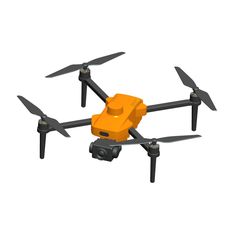
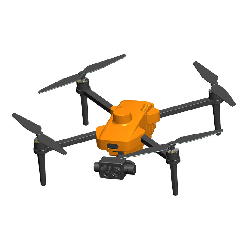
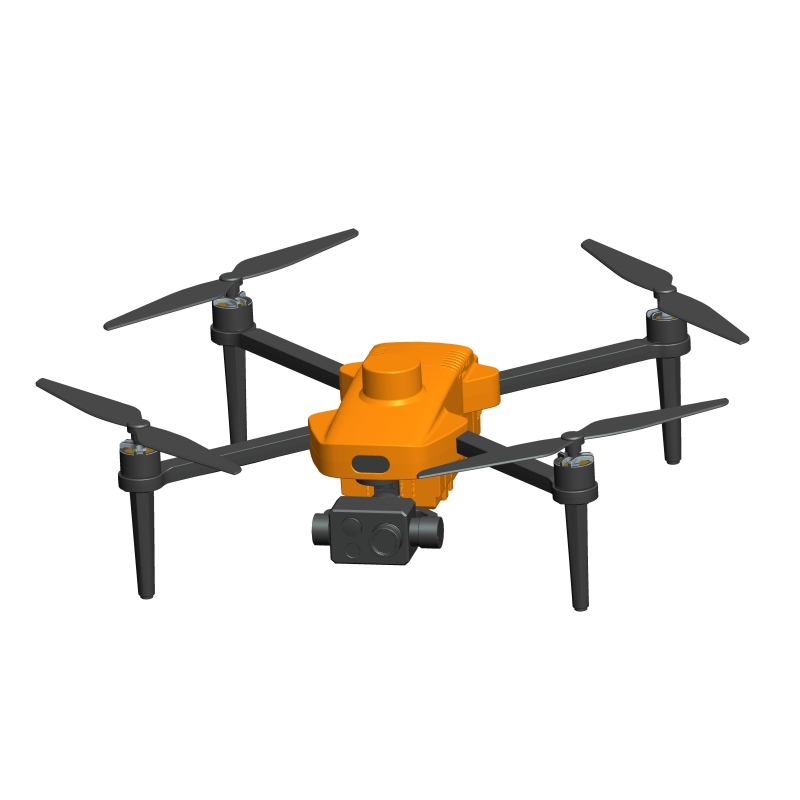
With the continuous advancement of science and technology, the application of drone technology in the field of surveying and mapping is becoming more and more extensive. In particular, single-light mapping quadrotor drone, with its flexibility, efficiency and precision, has become an indispensable tool in modern surveying and mapping work.
1. The unique advantages of the single-light lighting system
The single-light lighting system is a highlight of the single-light mapping quadrotor drone. It not only provides enough light to ensure a clear view at night or in low light conditions, but also has the following unique advantages:
High brightness and low energy consumption: Single-light systems usually use LED light sources, which have the characteristics of high brightness and low energy consumption. This enables drones to maintain stable lighting effects during long-term flights without frequent battery replacement.
Intelligent adjustment function: Some advanced single-light systems are equipped with light sensors that can automatically adjust the light intensity according to the brightness of the surrounding environment. This intelligent adjustment function not only improves energy efficiency, but also avoids interference caused by excessive lighting.
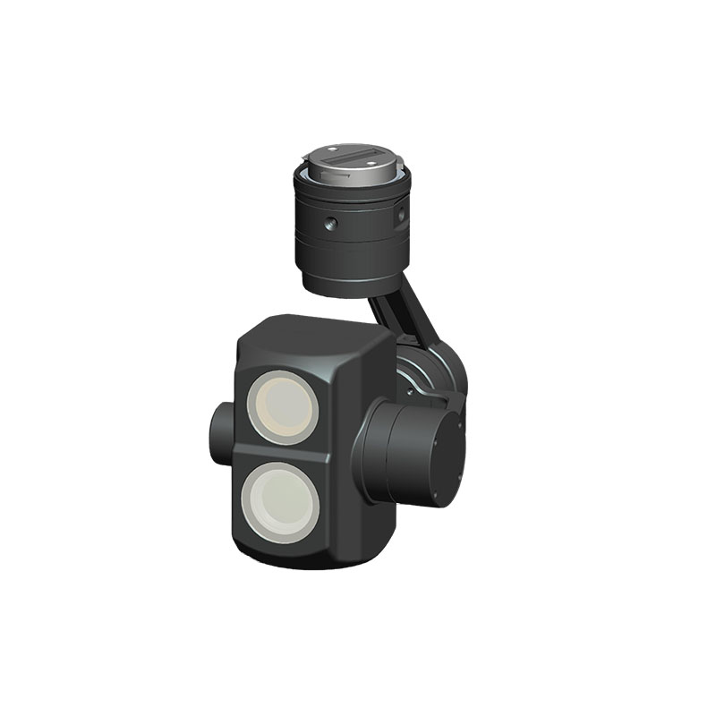
Directional lighting: The single-light system can achieve precise directional lighting, allowing operators to focus on specific areas, thereby improving surveying and mapping accuracy.
2. Ability to cope with complex terrain
In practical applications, single-light mapping quadrotor drones need to face various complex terrain conditions, such as mountains, forests, rivers, etc. The following are the key factors for their excellent performance in these environments:
High maneuverability: The quadrotor design gives the drone extremely high maneuverability and flexibility, allowing it to easily pass through narrow spaces or fly freely between obstacles. Whether in dense forests or rugged mountains, the drone can find a suitable flight path.
Real-time data feedback: By integrating high-definition cameras and sensors, single-light mapping drones can transmit images and data to ground stations in real time. This not only helps operators adjust flight routes in a timely manner, but also provides accurate basic information for subsequent data processing.
Anti-shock design: In order to cope with complex terrain changes, single-light mapping drones are usually equipped with professional anti-shock devices. These devices can effectively reduce image blur or data loss caused by vibration during flight, ensuring the quality of collected data.
3. Adapt to extreme climatic conditions
In addition to terrain challenges, single-light mapping quadrotor drones also need to cope with extreme climatic conditions, such as high temperature, low temperature, strong wind, and rain and snow. To this end, manufacturers have taken a series of measures to enhance the adaptability of equipment:
Weather-resistant materials: The body shell is made of high-strength, corrosion-resistant materials that can withstand the effects of wind and rain erosion and temperature changes. Some models also adopt waterproof and dustproof designs, reaching IP67 or even higher protection levels.
Temperature control system: The built-in temperature control system can automatically adjust the internal temperature to prevent electronic components from failing due to overheating or overcooling. This is especially important for operations in extremely cold or tropical areas.
Wind resistance: The quadrotor structure itself has good wind resistance stability, but in order to further improve performance, some high-end models are also equipped with advanced flight control systems. The system can dynamically adjust the flight attitude according to wind speed and direction to ensure stable flight.
4. Multi-functional application examples
Single-light mapping quadrotor drone has strong adaptability, so it is widely used in many fields. The following are several typical application scenarios:
Urban planning and construction: During urban construction, single-light mapping drones can quickly obtain detailed information such as the height and location of buildings, helping planners to develop more reasonable construction plans. In addition, the ability to operate at night also enables drones to collect data without affecting normal traffic.
Agricultural monitoring: By carrying a multispectral camera, the single-light mapping drone can assess the health status of farmland crops, detect pests and diseases, and so on. Even in the early morning or evening when there is insufficient light, the single-light system can ensure high-quality imaging.
Emergency rescue: After a natural disaster, the single-light mapping drone can quickly arrive at the scene and use its strong adaptability to conduct disaster assessment and rescue command. Whether it is a flood-inundated area or an earthquake ruin, the drone can provide key first-hand information.
Archaeological exploration: For archaeologists, the single-light mapping drone can comprehensively scan and model ancient monuments without destroying the ruins. Especially in caves or underground tombs with dim light, the role of the single-light lighting system is particularly prominent.
In short, the single-light mapping quadrotor drone has shown great potential in many fields with its excellent adaptability. Whether it is facing complex terrain or extreme climatic conditions, it is capable of various tasks and provides users with reliable data support and service guarantees.
1. The unique advantages of the single-light lighting system
The single-light lighting system is a highlight of the single-light mapping quadrotor drone. It not only provides enough light to ensure a clear view at night or in low light conditions, but also has the following unique advantages:
High brightness and low energy consumption: Single-light systems usually use LED light sources, which have the characteristics of high brightness and low energy consumption. This enables drones to maintain stable lighting effects during long-term flights without frequent battery replacement.
Intelligent adjustment function: Some advanced single-light systems are equipped with light sensors that can automatically adjust the light intensity according to the brightness of the surrounding environment. This intelligent adjustment function not only improves energy efficiency, but also avoids interference caused by excessive lighting.
Directional lighting: The single-light system can achieve precise directional lighting, allowing operators to focus on specific areas, thereby improving surveying and mapping accuracy.
2. Ability to cope with complex terrain
In practical applications, single-light mapping quadrotor drones need to face various complex terrain conditions, such as mountains, forests, rivers, etc. The following are the key factors for their excellent performance in these environments:
High maneuverability: The quadrotor design gives the drone extremely high maneuverability and flexibility, allowing it to easily pass through narrow spaces or fly freely between obstacles. Whether in dense forests or rugged mountains, the drone can find a suitable flight path.
Real-time data feedback: By integrating high-definition cameras and sensors, single-light mapping drones can transmit images and data to ground stations in real time. This not only helps operators adjust flight routes in a timely manner, but also provides accurate basic information for subsequent data processing.
Anti-shock design: In order to cope with complex terrain changes, single-light mapping drones are usually equipped with professional anti-shock devices. These devices can effectively reduce image blur or data loss caused by vibration during flight, ensuring the quality of collected data.
3. Adapt to extreme climatic conditions
In addition to terrain challenges, single-light mapping quadrotor drones also need to cope with extreme climatic conditions, such as high temperature, low temperature, strong wind, and rain and snow. To this end, manufacturers have taken a series of measures to enhance the adaptability of equipment:
Weather-resistant materials: The body shell is made of high-strength, corrosion-resistant materials that can withstand the effects of wind and rain erosion and temperature changes. Some models also adopt waterproof and dustproof designs, reaching IP67 or even higher protection levels.
Temperature control system: The built-in temperature control system can automatically adjust the internal temperature to prevent electronic components from failing due to overheating or overcooling. This is especially important for operations in extremely cold or tropical areas.
Wind resistance: The quadrotor structure itself has good wind resistance stability, but in order to further improve performance, some high-end models are also equipped with advanced flight control systems. The system can dynamically adjust the flight attitude according to wind speed and direction to ensure stable flight.
4. Multi-functional application examples
Single-light mapping quadrotor drone has strong adaptability, so it is widely used in many fields. The following are several typical application scenarios:
Urban planning and construction: During urban construction, single-light mapping drones can quickly obtain detailed information such as the height and location of buildings, helping planners to develop more reasonable construction plans. In addition, the ability to operate at night also enables drones to collect data without affecting normal traffic.
Agricultural monitoring: By carrying a multispectral camera, the single-light mapping drone can assess the health status of farmland crops, detect pests and diseases, and so on. Even in the early morning or evening when there is insufficient light, the single-light system can ensure high-quality imaging.
Emergency rescue: After a natural disaster, the single-light mapping drone can quickly arrive at the scene and use its strong adaptability to conduct disaster assessment and rescue command. Whether it is a flood-inundated area or an earthquake ruin, the drone can provide key first-hand information.
Archaeological exploration: For archaeologists, the single-light mapping drone can comprehensively scan and model ancient monuments without destroying the ruins. Especially in caves or underground tombs with dim light, the role of the single-light lighting system is particularly prominent.
In short, the single-light mapping quadrotor drone has shown great potential in many fields with its excellent adaptability. Whether it is facing complex terrain or extreme climatic conditions, it is capable of various tasks and provides users with reliable data support and service guarantees.